Photos: Day 2 Floods in Manila #floodsPH
Manila thought the worst was over. We woke up to the good news that Pagasa’s color coded warning signal was lowered to yellow. At 2:00 PM, the rains started to pour and as of this writing at 5:14 PM, the flood waters are starting to rise again. The downpour seems to be stronger than yesterday. Red warning signal was issued by @dost_Pagasa at 04:30 PM, 08 August 2012 (Wednesday)
Target Areas: Metro Manila
Torrential Rainfall (30.0-50.0 mm/hr) over QC, Manila & Marikina, Heavy to Intense rainfall (15.0-30.0 mm/hr) over Pasig, CAMANAVA, Taguig & Pasay while Moderate to Heavy rainfall (7.5-15.0 mm/hr) over the rest of Metro Manila.
Due to the effect of the series of thunderstorms embedded in the Southwest Monsoon, expect Heavy to Intense (15.0-30.0mm/hr) rains with occasional Torrential (more than 30.0mm/hr) rains within 2hrs.
Residents in flood/landslides risk areas are advised to take precautionary measures and WATCH OUT for the next warning.
@dost_pagasa announced that as of 05:25PM: At 05:00PM observation: Torrential rainfall (40.0-55.0 mm/hr) over QC and Marikina, Heavy to Intense rainfall (15.0-25.0 mm/hr) over Manila, North of Caloocan and Pasig while Moderate to Heavy rainfall (5.0-15.0 mm/hr) over the rest of Metro Manila. #ncr
Further explanation as of 05:45PM shows that ” Sudden downpour of Heavy to Torrential rains was experienced during the past 2-3 hours in most parts of Metro Manila and some surrounding areas. The rains were caused by the occurence of a series of thunderstorm which is commonly associated with rains of high intensity. We will closely monitor weather developments and provide updates.pagasadost ”
Here are some photos shared by tweeps.
Here are photos from yesterday
Bantay Banahaw for this Holy Week
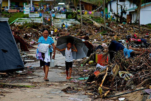
Post-Yolanda: Aquino’s disaster conspiracy with World Bank, ADB
Senator @piacayetano filed Senate Bill no. 3402 to repeal law that punishes offending religious feelings
About The Author
Noemi Lardizabal-Dado
Noemi Lardizabal-Dado is a content strategist with over 19 years of experience in blogging, content management, citizen advocacy, and media literacy, and over 30 years in web development. Otherwise known as @MomBlogger on social media, she believes in making a difference in the lives of her children by advocating for social change that benefits the greater good. She is a co-founder and a member of the editorial board of Blog Watch . She is a resource speaker on media literacy, social media, blogging, digital citizenship, good governance, transparency, parenting, women’s rights, wellness, and cyber safety. Her personal blogs such as aboutmyrecovery.com (parenting) , pinoyfoodblog.com (recipes), techiegadgets.com (gadgets) and benguetarabica.coffee keep her busy outside of Blog Watch. Disclosure: I am an advocate. I am NOT neutral. I will NOT give social media mileage to members of political clans, epal, a previous candidate for the same position and those I believe are a waste of taxpayers' money. I do not support or belong to any political party. I was part of accredited media covering the Office of the Vice President and Leni Robredo as she ran as a presidential aspirant in the 2022 National and local elections. On August 5, 2021, YouTube announced that I was selected as one of 50 Program participants of its Creator Program for Independent Journalists She was a Senior Consultant for ALL media engagements for the PCOO-led Committee on Media Affairs & Strategic Communications (CMASC) under the ASEAN 2017 National Organizing Council from January 4 -July 5, 2017. Having been an ASEAN advocate since 2011, she has written extensively about the benefits of the ASEAN community and as a region of opportunities on Blog Watch and aboutmyrecovery.com. Organization affiliation includes Consortium on Democracy and Disinformation Updated June 6, 2022